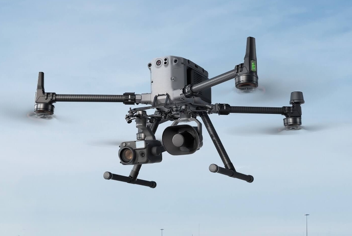
SENSOR LINEUP
Payload appropriate for the mission,
Payload appropriate for the mission,
watertight data acquisition
RGB, multi-spectral, lidar, thermal imaging, RTK, and drone accessories – a lineup of high-performance sensors optimized for industrial missions
By Industry Core specifications Meet
We recommend the optimal payload combination according to field work and aircraft compatible version.

Main application areas
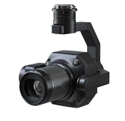
Public safety and infrastructure inspectionsIt identifies targets precisely even from a distance and assists in rescue operations.
Core specifications
40 million pixel zoom camera34x optical zoom and up to 400x digital zoom
Smart night vision functionProvides clear color images even in dark environments
compatible aircraft
DJI Matrice 400 RTKProvides maximum stability with perfect compatibility
Main application areas
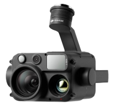
Fire suppression and thermal imaging inspectionNight search, fire scene analysis and solar panel defect detection
Core specifications
1280x1024 high-resolution thermal imagePrecise visualization of subtle temperature differences
Visible light split screenSimultaneous comparative analysis of visual and thermal images
compatible aircraft
DJI Matrice 400 RTKSupports the best dual payload combinations
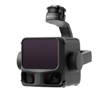
Main application areas
Precision aerial surveying and 3D modelingProducing centimeter-level precision topographic maps for civil engineering and construction sites
Core specifications
40 million pixel full frame mechanical shutterCover a vast area in one flight
mechanical global shutterProvides clear images without distortion during high-speed flight
compatible aircraft
DJI Matrice 400 RTKOptimized flight control and RTK data linkage
Main application areas
Digital twin of complex terrainForest resource survey, transmission line inspection, and earthwork volume calculation
Core specifications
Ultra-dense point cloudHigh penetration rate and hundreds of thousands of laser emissions per second
100 million pixel RGB camera combinationReal-time rendering of realistic 3D models with color information
compatible aircraft
DJI Matrice 400 RTKSupports stable power supply and data transmission
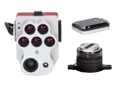
Main application areas
Precision agriculture and environmental monitoringIdentify moisture stress and disease in crops and optimize control
Core specifications
Thermal imaging + multispectral simultaneous captureObtain temperature distribution and vegetation index at once
Supports perfect installation on dronesProvides clearer, high-resolution multispectral images
compatible aircraft
DJI Matrice Series (SkyPort)Easy installation, plug and play

Main application areas
Error-free, unmanned automated missionSecure perfect positioning without reference points (GCP) at construction and surveying sites
Core specifications
Multiple global satellite system supportReceive signals from around the world including GPS, GLONASS, Galileo, etc.
Built-in communication relay moduleDramatically expands communication distance even in environments with many obstacles
compatible aircraft
All DJI Enterprise modelsSupports all industrial drones equipped with RTK module
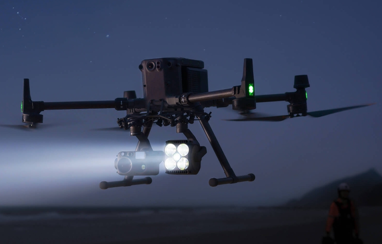
Main application areas
Night Search and Rescue (SAR)Projects intensive lighting into mountainous areas or disaster sites where there is no light.
Core specifications
Ultra-high output LED arrayClear ground visibility even at hundreds of meters above ground
Drone power system integrationStable light projection for a long time without a separate battery
compatible aircraft
DJI Matrice SeriesIntuitive fastening support for gimbal ports
Main application areas
Safety warning and remote controlVisible light split screen
Core specifications
Highly directional speaker driverReach clear voice over a long distance through noisy environments
Real-time microphone and recording transmissionReal-time conversation possible through remote controller microphone
compatible aircraft
DJI Matrice SeriesSafe and easy modular attachment system
Acquire clear, complete data in any environment.
We provide consultation on payloads optimized for the mission, such as thermal imaging, lidar, and zoom cameras.